Visionary
Hill Site |
|
|
|
|
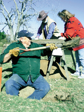
8/20/2002 BILL YOUNG: Visionary Hill, the oldest recorded historic site locally When I first started studying archeology, I acquired several books pertaining to the basic principals on how to do surveys and the recording of sites. The following description of how a site was discovered by my wife, Bobbie Jean, and my daughter, Julie, is a totally new method. I don't think this method will ever be published in an archeological book as a recommended procedure for discovering sites. A little over 20 years ago at about the time the archeologists at SMU were in the process of writing up the Richland/Chambers report, my wife, Bobbie Jean, received a phone call from a couple who wanted her to list a two-acre tract of land. My wife, who had been a realtor for many years, went out to the location and met with the owners. After she checked the acreage and got a signed listing agreement, she came back to our house and told our oldest daughter, Julie, that it was an extremely pretty tract of land with an exceptional view. She then expressed an interest to Julie in trying to get me to purchase the land. Julie stated, "The only way Daddy would buy the land, it would have to have an Indian site." So the two of them went back out to the place to see what they might find. When I got home from work that night, I saw two small piles of material sitting on the kitchen counter top. One pile was comprised solely of chert chips and flakes. Sure enough, there was an Indian site of some unknown time period on the land. The second pile was made up of a few broken plates, cup and saucers, along with a few shards of glass. Some of the ceramics had different forms of decorations. Bobbie Jean stated that she thought that the decorated pieces were very early based on her knowledge of antiques. Needless to say, they had instilled a little bit of interest in me with the artifacts. The following day, I went out to the location and walked around looking on top of the many gopher mounds that covered part of the site. On one mound, I discovered a "Waco Sinker" and with this discovery of a 9,000-year-old object, I was really hooked into keeping up with this site. Several weeks later, another tract located next to this one sold and the new landowner had a bulldozer push up much of his top soil for the pad where he planned to build. A day or two later, we received a heavy rain which resulted in a lot of material being washed out of the soil. In a matter of a few hours, I collected a cigar box full of mainly ceramic and glass but also some Native American artifacts. A few days later, I made a trip to Dallas to meet with the head of the historical archeologists on the Richland/Chambers project. When he opened the cigar box, his first comment was "Where in the world did you find this material?" I explained to him the exact location to which he then replied, " ---- you amateurs, we spent four years and $600,000 in the Richland/Chambers project and did not discover a house site this old." Within a few months, the site was officially recorded by Bobbie Jean and myself resulting in the Texas Archeological Research Lab, otherwise known as TARL, issuing the number 41 NV 540 for the site. This meant that this site was the 540th site officially recorded in Navarro County. Needless to say, most of the recorded sites are within or near the Richland/Chambers Lake project. Our field number for the same location is X41 NV 158 which means it was the 158th site recorded by us. Most of the artifacts collected over the years from the site have our field number marked on each object. One Saturday, several of the archeologists along with Bobbie Jean and myself started excavating 50 cm X 50 cm units on 4 meter intervals across the site. By using the property line between the two-acre tract and the neighbors new house site as a base line for the East/West and a North/South fence for the other two directions of the compass, we did not have to establish a new set of compass directions, necessary before excavations can begin. The object of placing 50 x 50s across a historical site is to establish the limits of the yard area when the house was standing. Also, if enough units are plotted onto a grid program in SMU's computer, the outline of where the house once stood along with the placement of each window and door will be displayed. We eventually excavated a total of 66 units across the site but did not complete the entire number of units necessary to determine the exact outline of the yard. However, we do feel comfortable in saying that this structure was a double-pen dog trot log cabin facing slightly east of south. The average size of the square nails recovered and the locations of the nails helped us in determining the size of the structure and the fact that the house was made of logs. Most of the nails recovered were approximately 30 to 35 centimeters in length or about 1-inch long. This size nail was used to hold the roof shingles usually made of cedar. We did discover larger nails but only in a limited quantity. Most were about the size of an 8 or 12 penny nail. These nails would have been used to attach the rafters to the top sill logs. There absolutely weren't enough 8, 12 or 16 penny nails found to indicate milled lumber. Next week: Who lived at the visionary site August 26, 2002 8/27 BILL YOUNG: Who lived at the Visionary Hill site? I think it might be appropriate if I spent a few lines explaining last week's title before continuing with this week's subject. When I made the statement that the Visionary Hill site is the oldest recorded historic site in Navarro County, the key word is "recorded." There isn't any doubt there are other historic sites here that will pre-date Visionary Hill by five or more years. The settlements of Bazette, Dresden (Melton), and Spring Hill all started before 1845. There were settlers such as William Love and Dr. Anderson and a few others living along Richland Creek near Pisgah Ridge prior to 1848. William Petty of Petty's Chapel fame was here also very early. Even the town of Taos was established just prior to 1850 and a small settlement known as the Richardson settlement was located within the current city limits of Corsicana. However, none of these sites have an official historical designation issued by the Texas Archeological Research Lab. The log structure located one block east of the Navarro County jail on West First Avenue has an official number and is tree ring dated to the year of 1848. However, all of the logs are numbered indicating that this three room log structure has been moved from its original location. At Visionary Hill, the log cabin was constructed by 1851 and maybe slightly earlier, then the structure probably burned down in the middle to late 1860s but the site is there. This currently makes this the oldest "recorded" historic site in the county. Now to the history of the land and who may have built the cabin. Thanks to Mrs. Dockery at the Navarro County Abstract Company, I was able to acquire copies of the various deed transactions that occurred from 1837 to the 1880s. Needless to say, there have been many other sales and deeds pertaining to various portions out of the original tract since 1885 but I am only interested in the first 30 or so years of documented history pertaining to this tract of land and who might have built the house. On Dec. 6, 1837, a bounty certificate, #7561 was issued in Houston to John H. Yerby in the amount of 960 acres. I have not found any evidence that Mr. Yerby ever came here to inspect or do anything with his land. The next year, 1838, Mr. Yerby sold this tract of land to Nathaniel Watrous. When we were researching various deeds for the Richland/Chambers Lake project, we discovered that Mr. Watrous originally owned several tracts of land here in Navarro County. It turns out that he was a large land speculator. What I did not know about him until last week was the fact that he was a senator in the Republic of Texas and a land surveyor. These two facts were noted in one of the papers that I got from Mrs. Dockery. The same paper stated that Nathaniel Watrous bought a number of land certificates in other people's names and located them. It also stated that he bought other patents that had never been located so he would locate these in his name. I did find one notation on the 1840 tax rolls for the Republic of Texas that Nathaniel Watrous owed back taxes on a lot he owned in Galveston but I am not aware of any evidence that states he actually lived there. Nathaniel Watrous died in Austin in 1842. Surviving him were three brothers, two sisters and his mother, Lydia Ann Watrous who resided in Shelby County, Ala. It seems that the Yerby tract passed to one of his brothers, John C. Watrous, and his mother, Lydia. Lydia signed over a power of attorney to John C. on Oct. 22, 1849. From here on, there is quite a lot of "action" pertaining to all or part of the original 960 acres and I need the aid of a real estate attorney to help me make heads or tails of what exactly happened. It looks as if John Watrous was conducting several sales pertaining to this tract and others, while here on the local scene, other people were selling and filing deeds at about the same time. John Watrous along with his mother sold all 960 acres along with a number of other tracts of land located in various parts of the state to Laird M.H. Butler and his brother George Butler who are listed as merchants in Galveston on Dec. 24, 1849. Then there is a mortgage deed from John Watrous to George Butler dated March 1, 1850. Then the two Butler brothers sold this tract along with several other tracts for a combined total of nearly 8,000 acres for a sum of $5,000 with a 8 percent annual interest fee to A. William Lee/Lees. One paper shows singular while another is plural. After that transaction, the Lee or Lees doesn't appear again. On the local scene, Wm. B. McCabe conveys the land to Radford Ellis on Feb. 8, 1850. On the census records in "Old Northwest Texas" by Knox and Henderson, Radford Ellis along with his family is enumerated and Mrs. Knox notes that Radford Ellis is residing in Jack County by 1855. Also in the same book, she wrote that William Croft, local attorney here in the early 1850s stated that Radford Ellis was something of a "character." Next week: More about the history of the land where Visionary Hill is
located. 9/3/2002 BILL YOUNG: Written history of Visionary Hill Before I continue with more about Visionary Hill, I want to say thanks to Richard Kelly for his letter to the editor. I have been pleasantly surprised about the number of people who read my little articles. Many of the terms used in archeology can be rather "dry" or in some cases, difficult to understand. Last week in the last paragraph, I wrote that Wm. B. McCabe conveyed all of the 960 acres where the Visionary Hill site is located to Randle Ellis on Feb. 8, 1850 but the document wasn't filed until Feb. 3, 1851. There is a large problem with this statement. I cannot discover any deed of whereby Wm. B. McCabe had any title to the tract of land in the first place. More research is needed! Continuing with the written documents. After Randle Ellis purchased the land, he, in turn, sold the same tract 11 days later after his deed was officially recorded. This time the land was sold to two owners, Wm. F. Henderson and R.N. White. These two names are already legendary in Navarro County history. William F. Henderson, a surveyor by trade, was one of the few surviving members of the survey party that was ambushed by Kickapoo and Kiowa Indians at the Battle of Battle Creek. The other gentleman, R.N. White, was the first county clerk of the newly formed Navarro County. There is a Texas Historical Commission marker erected in front of the Dawson and Sodd attorneys' office located at the corner of West Fifth Avenue and North Main Street. On Dec. 12, 1851, Wm. F. Henderson sold the lower half of the John Yerby survey to Ashley N. Randle. This acreage would amount to 480 acres and is a good indicator that Mr. Henderson decided to divide the land equally through the middle with each individual owning 480 acres. Within this 480-acre section is the location of the Visionary Hill site. For those of you who might wonder how the name of Visionary Hill was selected by my wife, Bobbie Jean and myself, we envisioned building a house on the hilltop, then we would be able to experience the same view as the original settlers. Eventually we sold the property since we probably would have killed each other trying to decided exactly what to build. With my 30 years experience in the concrete business and the fact that our soils are notorious for moving up and down, I would have required a foundation so strong that we would have used all of our money in the concrete work and have nothing left for the lumber. On the other side of the fence, Bobbie Jean had spent 18 years in the real estate business. On different occasions, she would come home and announce that she had been in a house and "liked" this particular room. A month later, she "liked" another room in another house. At the rate she was going, I was considering building the house in modular units similar to the construction methods employed by the Japanese. They cast each room out of light weight concrete. Then, with the aid of a crane, each room is stacked into place creating an apartment complex. Two years later, R.N. White sold off 100 acres to Robert Carruthers. It is my opinion that this section was located in the northeast corner of the original tract. This is another indication that the two individuals divided up the property. For 1851, when Ashley Randle purchased the southern 480 acres from Mr. Henderson, until Aug. 10, 1860, there is no further mention of this section. However on the above 1860 date, the sheriff sold all of the 960-acre block of land for back taxes. If I am reading the papers correctly, the back taxes were owed by John C. Watrous and George Butler. This indicates to me that all of the transactions that occurred around 1850 or later were null and void. Then, another sheriff's sale was recorded on Sept. 9, 1869 selling 200 acres located in the northwest corner of the original tract to Roger Q. Mills. I feel sure that most readers know who Sen. Roger Mills was and the location of his house on West Second Avenue in Corsicana. Everything pertaining to this 200-acre sale must have been proper and correct because deeds written after that point only refer to a 760-acre tract. On Sept. 12, 1871, Daniel W. Gill, attorney for several members and descendants of John C. Watrous, conveyed a 200-foot wide strip of land through the original tract to the Houston & Texas Central Railroad. This would coincide with the year that the H.&T.C. Railroad came through Navarro County on its way to Dallas. And finally, another instrument states that the remainder of the 760-acre tract passed to Nancy B. Watrous dated October 1871. I have not tried to research any deeds past this 1871 date since we feel sure that the original house built on Visionary Hill probably burned down sometime during the 1860s. Next time: The land changes that have affected Visionary Hill 9/10/2002 BILL YOUNG: Investigating who lived at Visionary Hill location Two weeks ago, my title for that week was "Who lived at the Visionary Site?" Did anyone notice that I have avoided answering the question? That is because I still cannot give an answer with a 100 percent certainty. I was hoping that in the past two weeks, I would be able to discover one document that proved without a shadow of doubt as to the owner of the house at Visionary. For now, it is my opinion that Radford Ellis built the house, probably before he officially purchased the tract of land. I am basing this assumption on a description written in "Knox and Henderson's, Old Northwest Texas," of the route taken by the census taker in September 1850. He stated that he left Corsicana and proceeded south to the Beeman settlement. After he enumerated the people in this area, he proceeded to the west of Corsicana and finally around to the north of town. This would have him pass through the region where Visionary Hill was located. Since we know from the same book that by 1855, Radford Ellis is living in Jack County, it is obvious that the Ellis family did not stay at the Visionary site for more than a few years at most. When the southern half of the same tract of land was sold by William F. Henderson to Ashley N. Randle in December 1851, it is my opinion that Radford Ellis and his family were already removed from the county. In 1852, another person named Henderson patents the third class survey of Randle Ellis in the amount of 320 acres. This would indicate Mr. Ellis sold his patent without ever locating the land grant in this county. As a matter of fact, the Ellis patent was located only two tracts to the west of the John Yerby tract where Visionary Hill is located. I am speculating that after the Ellis family moved away from Visionary Hill, the Ashley N. Randle family moved into the structure. However, there is a major problem in trying to discover exactly who is in the Randle family and how are they related to John Randle. Again, using the "Knox and Henderson" book, the two authors mention the fact that the entire Randle family was missed on three separate census'. Since Ashley Randle did not own the land where Visionary Hill is located until after 1850, his family would not have been counted again until the census was taken in 1860. Somehow, they were missed when the 1860 census was taken. "Knox and Henderson" wrote that there was a John Randle along with several other members of the Randle family. They wrote that an A.V. or A.N. Randle was probably the son of John Randle and that this A. Randle bought the William Ladd inn in Corsicana in 1852 after Mr. Ladd passed away. I cannot prove or disprove if A.N. Randle was kin to the above John Randle but I can say with a certain degree of accuracy this A. N. Randle has to be the same Ashley N. Randle who bought the Visionary Hill tract of land. There is a third option pertaining to the residents of the log structure at Visionary Hill. On one page in the "Knox and Henderson" book, they have a map of early Corsicana and the surrounding area. On this particular map, they mention that the residents living in or near the settlement of Corsicana were either land owners or renters but that there were numerous squatters living on the perimeter of the community. They have indicated what areas were affected by both owners and squatters by shading parts of the map. Visionary Hill is within this shaded area. Of all of the choices, this concept that the Visionary Hill site was occupied by squatters is the least appealing to me. The artifacts do not indicate a person or people that I envision as a squatter. Maybe some day, we will find out for sure who lived there. Next week: What changes occur on the land at Visionary 9/17/2002 BILL YOUNG: How the land was modified at Visionary Hill On the 1850 census, Radford Ellis was listed as a farmer. However, he also registered his brand prior to his official purchase of the John Yerby tract which indicated that Mr. Ellis owned some type of stock, either cows or horses or perhaps both. As a farmer, Mr. Ellis would have started clearing and cultivating some of the sandy loam areas within the tract. I would surmise that he started near the house location and worked outward. Today, within a stone's throw of the house site, are a few very large post oak trees of sufficient age to have been standing when the Ellis family built the house and cleared the area. Exactly how much land was cleared by Mr. Ellis and what areas will never be known. After Ashley Randle and his family bought the place, we must assume that this family continued with the clearing and cultivation but probably only on a limited basis since Mr. Randle also owned an inn near the courthouse in downtown Corsicana. I sincerely doubt that either Mr. Ellis or Mr. Randle did any clearing of the flood plain of Briar Creek. This flat bottom land was heavily covered in timber when they lived on the place and plows were not available that were capable of breaking the dense black land soil that covers the flood plain. Now that I have mentioned Briar Creek, I will break one of my rules and discuss exactly where the site used to be located. Notice that I said, "used to be" since the new construction of a nice home has removed the area where the house known as Visionary Hill once stood. Typically, I never write where a site is located for several reasons. In most cases, the site may still be there in some form or another and might warrant further research. The second reason is most landowners don't want to be bothered by people wanting to walk across their places. Therefore it is best to leave the exact location of a site unmentioned. Most people reading this article know where Fannin School formally known as Zion's Rest School is located on North Beaton. Just past the school, the road splits with the left hand branch going northwest towards the Country Club and the community of Emhouse. The other branch continues straight and is still part of Beaton Street. Several blocks to the north, a road turns to the right that is called Wilson Road. I think that this is the original southern property line of the John Yerby survey and that the intersection of Beaton Street and the corner of Wilson Road represents the southwest corner of the 960 acres. Recently, I have discovered that my 1901 map of Navarro County has a problem with the drawing of the John Yerby survey that I need to research some more. If you continue north on the county road which was north Beaton, you will pass the Zion's Rest Cemetery. At the far end of the cemetery, a county road turns only to the right. This road will take you into several different subdivisions known as Hickory Hollow and Highland Estates I through IV. The Visionary Hill site is located at the back end of Highland Estates IV after one makes numerous right and left hand turns. Just a few yards to the east of the site is a barbed-wire fence that separates Highland Hill Estates IV from Dr. Joseph F. McNally Sr.'s Sweetbriar Ranch. All of Dr. McNally's ranch is part of the original John Yerby survey. Instead of turning into the Hickory Hollow-Highland Estates area, continue northward on the county road until you arrive at Briar Creek. At this point, look behind you at the straight portion of the road you have just traveled. This is a section of the west boundary line of the John Yerby survey. Then cross Briar Creek continuing along the same western boundary line to the next road that turns only to the right. This is the northwest corner of the original tract of land. This corner is the area where Roger Q. Mills purchased 200 acres out of the original tract. Later, after Mr. Mills bought this portion, a settlement known as Providence came into existence. Turn to the right at this intersection, several hundred yards down the road on the right, in a clump of post oak trees and brush, is the Providence Cemetery. This cemetery was for members of the black families who lived in and around the Providence community. If you continue to the east along the county road, you will arrive on a hill overlooking part of the flood plain of Chambers Creek. If the road was extended straight ahead to the west service road on Interstate 45, this would approximately represent the northeast corner of the John Yerby survey. Then proceed south on the business route of I-45 towards Corsicana. Somewhere near District Office of the Texas Conference Pentecostal Holiness is the southeast corner. Next week: What has happened in recent years at Visionary. 9/22/2002 BILL YOUNG: What happened at Visionary Hill in recent years How about this? A new day and time for my archeological stories. This really may change the life of one of my readers who is also a good friend. Typically he takes my article each week into the room with the half-moon on the door. He says he gets more out of the article when he is not disturbed and this room is the best place in the house for privacy. I must admit to keeping several archeological books in my rest room for the same reason. I have not researched any deeds later than the late 1860s pertaining to the land surrounding the Visionary Hill site. The reason is we are convinced the house site was not occupied for any length of time after around 1867. There is a small amount of material that we recovered that dates after 1870 but not enough to indicate any permanent residence. Several things have happened to the site since 1930. Someone built four parallel terraces starting at the crest of the knoll proceeding down the northern slope. Since the advent of building terraces to keep the land from eroding didn't start until the late 1930s and 1940s, I feel sure these terraces were built somewhere around 1940. On the opposite side of the ridge, the construction of streets and homes has removed any evidence of man made terraces. Three of the four terraces start at the barbed wire fence separating the knoll where the log house stood and the land known as Sweetbriar Ranch. There isn't any evidence of a terrace ever having been built on this ranch. This indicates that whoever built the terraces did not own any of the Sweetbriar Ranch land. The construction of the four terraces directly impacted the Visionary Hill site. Artifacts belonging to the site have been found in limited numbers several hundred yards from the original site. Also, the section of terrace where the house stood is gone. I do not know if this indicates whether the house was still standing at the time the terraces were built or someone removed this section in an effort to fill in the well located at the house site. Just how long any of this land was cultivated is another unanswered question. Mrs. Donnie Dobbs was kind enough to let me look at a 1926 colored map of the soils of Navarro County. There were several houses marked on this map including one house on the next knoll to the west of the Visionary Hill location. I have looked at this location several times and determined the glass and ceramics date from the turn of the century to around 1950. It is my opinion whoever lived in this structure probably was the individual who constructed the terraces and raised crops along the ridge. For a number of years after the cultivation of crops ceased, there wasn't any activity until Carl Wayne Morris purchased the land and subdivided the acreage into lots. When he started the subdivision, he also installed utilities and built rock roads across the area. Some of this activity probably affected part of the Visionary Hill site but nothing was modified in the exact area where the log house once was located. For several years, the lot grew up in dense brush and briars. Without a doubt, it is obvious why the name of Briar Creek was applied to the nearby creek. Mr. and Mrs. Charles Harrison bought a lot located on the circle across from the Visionary Hill lot. The lot in between Visionary and the Harrison lot was sold to Mr. and Mrs. Gary McMullin. At the time when the McMullins bulldozed their lot, part of the actual Visionary Hill house site was affected. This was the beginning of the eventual end of the site in an archeological context. Finally after my wife, Bobbie Jean, and I bought the two acres, we started the painful process of clearing away the problems. There are several nice trees scattered across the lot but we could not see them except for their tops due to the briars. From that time until very recently, nothing much occurred to change the situation. We finished the clearing and occasionally mowed the lot but the soil was not modified except for the tunnels dug by the gophers. A lot of credit needs to go to those gophers. If it had not been for their tunneling and subsequent dirt piles, Visionary Hill would not have been discovered. On a sad note, the gophers were eventually eradicated by the fire ant population that moved onto the site in later years. Slightly over three years ago, Bobbie Jean and I bought an older home in town and decided to sell Visionary. Mr. and Mrs. Tom Lester bought the lot from us and held it until recently selling it to Dr. and Mrs. Robert Cole, who contracted with Monty Brazell to build for them a beautiful home on the site. Dr. Cole and his wife along with Mr. Brazell gave their consent for me to continue watching for artifacts while the house is being constructed. Mr. Richard Rash was hired to bulldoze an area sufficient for the construction of the house. Mr. Brazell contacted me when the dozer work was starting so that I might be able to watch and recover any artifacts while the bulldozer was working. I must thank Mr. Rash for being a little patient and not running over me or burying me in the fill dirt. There were several occasions when I needed a second person. When I was in front of the machine, I would see something behind the dozer and vice versa. But for the most part, I was able to salvage a lot of artifacts associated with Visionary Hill. Next week: Some of the material recovered from Visionary. 9/29/2002 BILL YOUNG: What was found at Visionary Hill site? In one of my earlier articles, I wrote about the various stone materials available to the Native Americans for the manufacturing of tools and weapon tips. Locally, there are only two sources. One is the Pisgah Ridge material found embedded in the limestone outcrops in a small section of Pisgah Ridge. The other material is commonly called Uvalde gravel which occurs in various areas across the county. The Uvalde material was heavily utilized in this region during the middle and late archaic periods ranging in age from 6,000 to 2,000 years ago. Then after the bow and arrow was invented, the next group of Native Americans produced arrow points made from the Uvalde gravel. On the sandy ridge where the Visionary Hill site is located is a shallow and skimpy Uvalde deposit. I think that occasionally, a cobble of sufficient size to produce a stone tip would be found exposed somewhere near the site. However, I think that most of the utilized material was brought from a major deposit of Uvalde gravel located just behind Collins Middle School northward and slightly westward from the Country Club. If one were to ride down the dirt road that passes behind the club, there are numerous cobbles of sufficient size for the production of large dart points. When an archeologist discovers a site, he or she would prefer that the site has only a single component. In other words, only one occupation by a single group of Native Americans or a single settler with his family. In nearly all cases, this rarely occurs as most sites contain multiple occupations by various groups. If this is the case, hopefully, each occupation might be sealed within a certain level within the profile of the soil. At Visionary Hill, this was not the case. Thanks to the gopher population, the various time periods were sufficiently mixed so that controlled excavations would not produce any useful data. On the other hand, if the gophers had not been "doing their thing," Visionary Hill would not have been discovered. In the first article about Visionary Hill, I wrote that my wife, Bobbie Jean, and my daughter Julie, found a handful of flakes dispersed on the gopher mounds. After their visit, I decided to check the site and discovered a Waco Sinker resting on one of the mounds. This 9,000-year-old artifact still remains as the oldest artifact recovered from Visionary Hill. One Wells point that exhibits a lot of evidence of being resharpened dates to around 5,000 years ago and is the oldest dart point discovered. We have found several dart points and fragments which belong to the most common late archaic group within the Trinity basin that manufactured Gary points. And finally, we have recovered a total of six broken or whole arrow points. We are able to identify two different types. One is called Perdiz and the other is a Cuney point. Both types date to somewhere between 1400 A.D. to 1600 A.D. We also found two tiny, undecorated sherds of Native American pottery and one small piece of a pipe made by the Indians. Since none of the pottery pieces have any type of decoration, we cannot assign them to any particular time period. However, each piece has small fragments of ground-up pottery used as a tempering agent. This may indicate that the pieces belong to a time period dating around 1350 A.D. One thing that is very obvious is the absence of any stone tools such as scrapers, drills or knives. One "Bristol Biface" and one thumbnail scraper was found and one piece that resembles a crude drill but may be only a used and discarded dart point that was resharpened numerous times. Without any hard evidence of scraping or wood working tools, the artifacts recovered from Visionary Hill point to this site being used as a chipping site. This term means that various groups of Native Americans passing through this area along Briar Creek would stop on this high ridge and produce new stone projectile points for their dart and arrow shafts. At the same time, they would be able to overlook a fairly large area along the creek keeping watch for various types of game. If you were to stand on the site during the winter when the leaves have fallen, you can see the water tower at Rice if there isn't any haze which is a distance of possibly eight miles. This view plus the fact that we originally had a vision as to what we wanted to build on the site is the origin of the name, Visionary Hill. Within the first year of discovery, we decided to put in a number of test holes across the site to see just how much of the site might still be intact. On that first day, there were four archeologists along with Bobbie Jean and myself digging and screening the soil. We used the barbed wire fence that separates Sweet Briar Ranch from Visionary as the north/south boundary line. Then we used the property line that separates Gary McMullin's lot from Visionary as the east/west boundary line. Since we knew that material was over the line in both directions, we called the beginning intersection N30-W20. This way, we could go 30 meters into the McMullin yard without reaching a negative axis. For those of you who might remember plotting X and Y on apiece of graph paper, it was easier to compute if both the X and Y were in the plus (+) side. The same is true for the computer program used at SMU in archeology used to plot a historic house site. Over the years, we excavated a total of 64 units that measured 50 X 50 centimeters. For those of you who are not familiar with the metric system, two square point shovels wide is about the equivalent to 50 centimeters. Next week: The results of the excavations 10/20/2002 BILL YOUNG: The artifacts from the excavations at Visionary Hill Before I start discussing the artifacts from the excavation units at Visionary Hill, I want you to keep in mind that there have been multiple occupations on the site, both Native American and historic settlers. Even though we never completed enough of the 50 centimeter by 50 centimer units to determine the entire yard area for the house, the 64 units we did excavate plus two: 1-meter by 1-meter squares and a 1-meter by 2-meter unit, were sufficient to determine a lot about the site including where the house once stood. Starting at the southern end, three units were placed in a row at 20 meters south of the east/west base line. These units are located about 25 meters from the original house site and all three holes produced zero artifacts. Even though the depth of these units was reduced when the bulldozer pushed the top soil to build the pad for the McMullin house, it still is a good indicator that the formal yard area did not extend this far. Five units were placed on a 4-meter apart grid at a distance of 16 meters from the east/west base line. Everyone of these units produced a few artifacts but the overall count was quite low. In each unit, we found a few flakes associated with the prehistoric occupation and a few shards of glass, both bottle and table glass. In most of the units, one or two sherds of some type of either plain white or decorated ceramics were recovered. At 12 meters south of the base line, another row of five units on 4-meter intervals was placed. In each of these units the soil was slightly deeper and the artifact count increased slightly. Most of the material found was identical to the previous units except a couple of the units produced a few tiny fragments of rusted metal -- possibly can, and a few square nails. We excavated only two units at 8 meters west from the base line due to much of the top soil being removed by the dozer. Both units were placed 4 meters apart near the north/south line. The artifact count was approximately the same as the units in the line to the south. At 4 meters from the east/west base, we put in seven units, six of which are placed on the same 4-meter grid with one unit on a 2-meter interval 10 meters west of the north line. The prehistoric material, all flakes, increased along with the depth of the soil but nothing new was found. On the east/west base line, a total of eight holes were excavated on a 4-meter grid. At 40 and 44 meters west of the north line, the soil depth was greatly reduced due to the dozer work and in turn the artifact count for these two units was much smaller. In the units on both sides of 30 meters, the flakes recovered numbered as many as 30 flakes per unit. Keep in mind that a flake is a small piece of stone that was removed during the process of manufacturing stone projectile points. At Visionary Hill, the vast majority of flakes recovered are either secondary or interior flakes. This indicates that the Native Americans partially reduced the cobbles prior to bringing the material to the site for final completion of the stone tools. In one of the units near the house site, an oval black bead was recovered. This particular type of bead might have been a trade item with the Native Americans but in all likelihood the bead belongs with the historic component. In another unit, a fired percussion cap was found indicating the presence of one or more guns. In several of the units near the house site, tiny pieces of sand brick were found. Most of the fragments were smaller than your thumbnail. On the next row of units, we first excavated eight units on the 4-meter grid, then we placed six more units in between making most of this row on a 2-meter grid. Based on the volume of material that came from the units on the east/west base line, we felt sure that a least a portion of these 14 holes would be either under or along the edge of the structure. As we predicted, the quantity of square nails increased dramatically starting with the hole placed 12 meters west of the north line. The higher nail count continued for approximately 18 meters (50 feet). This high count indicated that the structure was probably a two-room log cabin with a dog trot in the middle between the rooms. Many of the early houses constructed in this area of Texas were typically two-room dog trot. Even after milled lumber became readily available, dog trot houses were still very popular in rural Texas until after the turn of the century. As more roads were built and the houses were orientated towards the road and not the prevailing south to southeast wind, the construction of dog trot homes ceased. In one unit located outside the eastern end of the house, a dense charcoal lens was encountered about 12 inches down and this same lens was noted in the next unit to the north. Within the charcoal lens in the first hole, several small pieces of egg shell were recovered. I would not have guessed that egg shell would have survived the past 150 years but there isn't any doubt it was present. Without question, the occupants of the house raised chickens that also laid eggs. 10/27/2002 BILL YOUNG: Going over what was found at Visionary Hill Last week, I wrote about most of the artifacts found in the 50-by-50 centimeter units and the three larger squares. In one of the 50-by-50s, a single musket ball was the only artifact recovered. This lead ball had not been fired as the casting sprue was still attached. A sprue is a small nipple of lead attached to the ball on one side. This protrusion was formed when the melted lead was poured into the bullet mold through a very small opening in the side of the mold. The individual casting the bullet could not tell when the mold was full until the mold overfilled into the casting hole. After the bullet was allowed to cool, the person would cut off the sprue making the bullet round. Some molds had a set of sharp pincers that were utilized in cutting the sprue while others didn't have a set of blades. This would require the person to use some other means such as a knife to remove the sprue. It was imperative that the sprue was removed before the bullet could be used. The first two categories that I will discuss leaves me with some unanswered questions. In these cases, the reader can draw his own conclusion as to what exactly happened pertaining to these artifacts. The first item I want to write about is the brick. All of the brick fragments recovered are comprised of the early type of hand made sand brick. There is no maker's mark on any of the bricks. If I glued all of the brick fragments recovered together, I might be able to reconstruct six or seven bricks. Because there were so few bricks found, several questions are brought to mind. One: The house never had a brick chimney which means there was little need for brick at the site. Two: The house had a stick and wattle chimney and only a few brick were needed for the hearth. This type of chimney was constructed by early settlers when brick was not readily available. Generally speaking, a stick and wattle chimney means a chimney produced from wet clay with small sticks placed in the clay as the chimney was constructed to give the chimney a certain amount of body and strength. One of the negative problems associated with this type of chimney is that during rainy periods, the clay would be subject to dissolving, especially during a hard driving rain. Three: After the structure burned down, all of the whole brick that survived the fire were recycled to another site by some individual. We are aware of this occurring at several other sites in north Texas. In fact, brick is probably the number one item to be recycled from an abandoned structure because bricks are both durable and easily transported to another location. At Visionary Hill, most of the larger pieces recovered were placed by someone near the boundary fence. This indicates to me that the area where the structure once stood was cultivated. Whoever did this plowing must have gone to the effort to remove from the field any objects such as bricks, foundation stones, large pieces of metal and possibly even bigger shards of glass bottles. We will never know if this cultivation was done with a team and plow or a motorized tractor. Either way, the person went to a lot of effort to remove anything that might hurt the mule/horse, or a tire on a tractor. One thing for sure, not one complete brick was found. For now, I am inclined to think that any useable brick was removed by someone to another location. Each reader needs to make his own decision as to what happened to the bricks at Visionary Hill. We do know from the 1850 Census of Navarro County that there was at least one individual here producing handmade bricks. The second main category that has a lot of unanswered questions is the bone and shell. The first one that I will discuss is the mussel shells found at the site. There are maybe two handfuls of both whole and broken mussel shell from the site. Most of the shell is comprised of juvenile mussels indicating that they were collected during late summer and fall. Now to the problem. Was this shell brought to this site by the Native Americans who used this hill from time to time over the centuries or did the early historic settlers collect the shell. We know that during the past three to four thousand years, the Native American population in North Texas collected and processed mussel as a secondary food source. I know that mussels are present today in Briar Creek and there are several locations that I have seen located along the creek channel where the Native Americans cooked batches of mussel. The distance from Visionary Hill to the creek is several hundred yards and it is not very common to find a prehistoric site this far removed from the main water source producing mussel shells. On the other side of the coin, the historic settlers at Visionary Hill might have collected these few shells because of their shiny surface. It is even conceivable that they might have cooked a few mussels just to see if the meat could be a secondary food source in hard times. Again the reader must make their own decision. I am leaning towards the Native Americans bringing the mussels back to the site. Next week: The bone and other artifacts from Visionary Hill 11/3/2002 BILL YOUNG: Other artifacts found at Visionary Hill Last week, I wrote about the mussel shell and made a speculation as to who might have brought it to the site. Another type of shell was found in small numbers at the location. A few complete snail shells of a variety that resembles a tiny conch shell were recovered. This type of snail is not the type that I find from time to time munching away at my shrubs and flowers. That snail has a spiral shell instead of a tapered shell. The type that we found at Visionary Hill are commonly recovered from flood plain sites, especially those sites where the Native Americans were processing mussel shells. Archeologists for years have debated whether the snails were also being cooked and eaten or if the snails entered the site after it was abandoned by the occupants. The general consensus is that the snails were attracted to the debris left from the cooking fires, especially the fatty grease left around the hearth. There must have been a fairly large amount left for the snails to consume and in turn, they overstuffed themselves causing many of the snails to die. I have found this particular type of snail under rotting logs and leaves but I don't recall ever having seen this species out in an open grassy area. So again, we must speculate why these few snails ended up at Visionary Hill. The next major category that I want to discuss is the bone found on the site. Once again readers must decide for themselves exactly who brought these animals to the site as a food source. We have found a number of long bones that are definitely deer. Also, there have been several teeth found that are unquestionably deer. Other teeth recovered are from pigs, including a few short tusks. Two bone objects are the noise makers from inside the head of a fish known locally as a drum. These two pieces are considerably different in size indicating at least two drums were eaten at Visionary Hill. We also found a few small hollow bones that belong to some type of bird, possibly chicken or turkey. I must admit that my ability to identify what species a bone belongs to is definitely lacking. Identifying bones and many abstract objects made from metal is not what I do best. Now, once again we must decide in our own minds as to who brought what to the location. It is my opinion that all of the animal bones found at Visionary Hill were brought there by the early settlers who lived on the site. Several of the larger deer bones have been cut diagonally with a sharp knife or possibly a very sharp ax. None of these bones exhibit parallel cutting marks which would indicate that the meat had been removed prior to cooking. On many of the Native American sites, there is evidence that most of the meat was removed and in many cases, the bone was then shattered so that the marrow could be removed and eaten. We see teeth marks on some of the bones indicating rodents at some time chewed on the bone, possibly trying to use the bone as a source for calcium. Another reason I think the bones are associated with the settlers is the volume of musket balls found on the site. With the aid of a metal detector, we found a handful of both fired and unfired balls of various calibers. I will discuss these at a later date when I write about the metal. Much of the bone recovered is in tiny fragments that I am unable to identify. If we are able to secure a small grant some time in the future, I will take all of the bone to someone who can correctly identify most of the material. In many of the 50 X 50 cm units, it was common to find 15 or 20 pieces of bone smaller than your thumbnail. I also think that some of the bones belong to the recently departed gophers that came in contact with the fire ant population that entered the location in the past 10 years. I will say that I know one thing fire ants are good for: Removing stumps. At the mission site in East Texas that I found back in 1983, the land owner had just cleared the land with a bulldozer prior to my discovering the site. The fire ants moved onto the site within a couple of years. Wherever a stump had been left, the ants built a mound next to the protruding stump. In less than three years most of the stumps had been consumed by the fire ants. This may mean the fire ants are some distant relative of the termite which could mean more trouble from them in the future. Another item that we found mainly on the screens were tiny fragments of charcoal. A few of the pieces are large enough that an expert on tree wood at Texas A&M could tell us the particular type of tree. Since we did recover a number of pieces of charcoal especially in the vicinity of the house site, we believe that at some point, the structure burned down. Next week: The metal and glass artifacts from Visionary Hill 11/10/2002 BILL YOUNG: Metal artifacts from Visionary Hill Metal artifacts from any archeological site sometimes cause me a lot of frustration when I try to identify them. Since many metal objects were fashioned by a blacksmith for some specific reason known only to the smithy and the person he is doing the work for, I sometimes feel I am grasping for a straw. The metal pieces recovered from Visionary Hill are no different. Granted, some of the metal artifacts are easily recognized but others leave me scratching my head causing some more of that already thinning cover that I call hair to get thinner. We found several pieces of flat bands approximately one inch wide that I believe to be metal staves from a barrel. We also recovered a portion of another band that I feel is part of the cover band around a wagon wheel. Another metal piece that I am sure came from a wagon I will try to describe. It is U-shaped and about 14 inches in length. From inside to inside of the "U," it is only four inches across. About three inches from the bottom of the "U" is a small round rod that connects from side to side. Six inches farther down the piece is another identical rod connecting the two sides. In between these two connecting rods are two loops. Each loop has one flat side while the rest of each loop is a completed circle. Both ends of the "U" have been bent at an angle in the same direction. A friend of mine happens to own an old wagon that still has most of the original metal intact and in place. I was able to find almost the same "U" attached on four separate corners of the wagon. We discovered the "U" is mounted upside down with a board in between the sides of the "U." The two connecting rods pass through the board and help hold the board in place. The wood is notched at precise intervals for the two loops to be held in place. These two loops hold one of the stays that went over the wagon from side to side and the canvas cover was attached to the stays. We also found two very long bolts that are part of a covered wagon and one-half of the metal end of the tongue of a wagon. Two flat straps that are beveled along the edge on one side were also found. These pieces have evenly spaced holes and were used to cover the edge of the wooden sides of a wagon to help prevent moisture from entering the edges of the wide planks. Three broken round-headed bolts are typical of the bolts used to hold the wooden wheel tight against the spokes. Only one portion of a worn out horseshoe was found and not a single horse shoe nail. At this point, I don't think this means the people living at Visionary Hill did not have several horses, I think it indicates that the horses were not kept next to the house but at another location near the structure, yet to be discovered. Two heavy iron buckles found on the site belong to some form of harness, either a harness for riding or a plow. Another smaller iron buckle is typical of the buckles found on a horse bridle. Several loops of a medium size, hand-forged chain may be part of the trace chain used on a plow. One of the most interesting types of metal recovered is the lead debris and musket balls. With the aid of a metal detector, a number of small pieces of lead were found. Most, if not all, are the result of the manufacturing of musket balls. When the person was casting lead balls in a bullet mold, small pieces of lead fell to the ground and the person never bothered to pick up the scrap pieces even though lead was hard to come by. We also found part of a lead bar with a portion of the manufacturers name on the bar. One piece of lead in the shape of one-half of a very large marble is the end result of the person melting a piece of lead in the crucible but not pouring the lead into the bullet mold. Instead, the piece was allowed to cool in the half-moon shape and entered the site in this form. The musket balls recovered from the site are of various calibers. Several are .32 caliber which is also the same size as "00" buck shot. We did find five 12-gauge shotgun shell casings on the site which means that some of the buckshot was originally loaded in these brass casings. However, some of the .32 caliber lead bullets still have the sprue attached which indicates that some one was casting .32 caliber musket balls at the site. This small caliber indicates a pistol. Most of the musket balls recovered are .36 caliber and several still have the sprue attached. For those of you who don't remember, the sprue is a small nipple of lead that is formed when the melted lead is poured into a bullet mold and a small amount fills in the opening where the lead is poured. This sprue must be removed so that the lead ball will be round. With the majority of lead balls being a .36 caliber, we are faced with a question. Were the .36 caliber balls cast for a pistol or a rifle or possibly both? There were a number of Kentucky rifles manufactured with this size diameter barrel. There were four balls found made of two larger size calibers. Two were in the range of .44 and the other two at .48 caliber. In both sizes, one each has been fired, and the other ball in each size is unfired. None of the unfired balls have any of the sprue remaining. Next week: More of the metal artifacts from Visionary Hill 11/17/2002 BILL YOUNG: Metal artifacts from Visionary Hill abound Last week, I neglected to comment about the .44 and .48 caliber musket balls. The size of each is still within the range of what is referred to as for use in a Kentucky rifle. However, we cannot determine if these musket balls were intended for use in a flintlock or a percussion cap gun. Percussion cap pistols and rifles were available prior to 1850 but many people could not afford to purchase one. It is documented that a number of men enlisting in one or the other sides at the onset of the Civil War brought their flintlocks with them on the day of enlistment. At Visionary Hill, we haven't found any gun flint or any portion of a flintlock gun. Without a doubt, at least part of the guns at Visionary Hill utilized percussion caps. During the excavations that first year, we found one fired percussion cap in one of the units placed near the front of the house. On another occasion, we found two other percussion caps, one fired and the other unfired. For me, the easiest description that I can think of to describe percussion caps is that they remind me of lead pellets for a pellet gun. A percussion cap is about the same size as the brass part on a pencil eraser. We also found the bottom portion of a brass can that held 100 percussion caps. At the Jones Plantation site, we recovered the top portion of a similar container. Another artifact associated with guns that we found at Visionary Hill is a tiny brass tip with two protrusions extending outward near the end. This is the brass tip from a cleaning rod that would fit into the barrel of a .32 caliber gun. It is possible that this might have been used in the .36 caliber gun from Visionary Hill but there is little doubt that it is too small for the bigger guns. Rim fire guns and shells came into use during the Civil War along with center fire guns and cases. One thing pertaining to rim and center fire shell casings that helps define the time range for Visionary Hill is the fact that we have not found casings belonging to the earlier time period. A few modern .22 shell cases were found but otherwise, not a single rim or center fire casing. The five shotgun casings that I mentioned last week belong to a later time period. Three other metal artifacts recovered from Visionary Hill associated with both horses and personal items are one complete brass spur and the two end loops off of another different type of brass spur. The complete spur was found by Mr. Charles Harrison whose house is located two lots away from Visionary Hill. Several years ago, Mr. Harrison had planted a garden on the eastern boundary of his property. On one occasion, he plowed up the spur and shortly thereafter, presented the spur to me. For those of you who are not aware, Mr. Harrison is also known by many people as "Santa Claus." During the Christmas season, he and his wife put up a lot of Christmas decorations and Mr. Harrison is noted for wearing his "Santa" outfit. The spur he gave me is marked "US" and is one of the types typically worn by the enlisted cavalrymen on the Northern side during the Civil War. However, this spur does not mean that one individual at Visionary Hill was a member of the northern armies. Several years into the war, the northern blockade was so successful that soldiers fighting on the side of the South were forced to scavenge the battlefield for objects of clothing. I have read that it is very rare to see a genuine Confederate uniform on display that doesn't have one or more of the "Eagle" (Northern) buttons sewn on. The two brass ends from another spur were found very near the original Visionary Hill house site. These two loops are much smaller that the spur described above. Just last week while visiting a museum in Clifton, I saw a spur with identical loops on display. Also, a friend of mine here in Corsicana has another identical spur. In one of my reference books on the artifacts from the Civil War, this particular spur is described as an officer's spur and was used by both sides but primarily the Southern officer wore this delicate spur. One kitchen utensil found the first year turned out to be an intrusive artifact dating much later that the original occupation. This is a very large kitchen spoon that I would call a bean spoon for a huge pot. When I originally found the spoon, I didn't notice the markings on one side. It was almost a year later when I happened to notice that the spoon had two very common words today branded on one side: Stainless Steel. Looking through several books, I found out that stainless steel wasn't invented until 1933. Therefore, someone at a much later date brought this spoon to the site. Although it is only a guess, I can imagine someone camping on the site cooking some type of food in a large iron kettle stirring the pot every now and then. When the cooking process was over, the individual set the spoon aside to allow it to cool. The next day, the spoon was forgotten and entered the site. The handle has been heavily twisted which indicates to me that the spoon was struck by a plow at some later time. Next week: The rest of the metal artifacts and some glass from Visionary Hill NEXT PAGE === >
Bill Young is a Daily Sun columnist. His column appears Tuesdays. Originally published in the Corsicana Daily Sun All rights to this story reserved. Copyright Corsicana Daily Sun and Community Newspaper Holdings, Inc,. Content may not be archived, retransmitted, saved in a database, or used for any commercial purpose without the express written permission of the Corsicana Daily Sun and CNHI.
|
![]() Navarro County TXGenWeb
Navarro County TXGenWeb
© Copyright
February, 2020
Edward L. Williams